
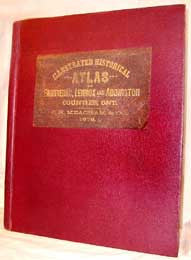
Illustrated Historical Atlas of Frontenac, Lennox and Addington Counties, Ontario
Cat No.: CA0168:
This Illustrated Historical Atlas is a great resource for researchers trying to locate people in the three important, adjacent counties of Frontenac, Lennox and Addington. Important because the city of Kingston, the one time seat of government in Canada, lies in the county of Frontenac and this was a major area for immigration for the United Empire Loyalists. The publication date for the atlas is 1878 and while it is silent about the age of the data - and the maps are undated - it probably represents the situation in the period between 1876 and 1878. (The latest date of settlement in the Patrons Directory is 1877 while the “Historical Description mentions events which took place in 1878.)
The atlas is organized into three contiguous parts. The first is a “Historical Description” and lays out the origins of non-native settlement in the area, concluding with written sketches of the townships, major population centers and the biographies of some of the leading citizens. Included in this section are two double page, full color, maps of “The Dominion of Canada,” east and west. There is an amazing amount of information contained in these maps but with this digitized copy you can zoom in to at least 800 times to easily read the smallest details.
The second section consists of a series of maps based on the official Canadian surveyor's work and on which are marked the boundaries of all the surveyed lots plus the allowances for concession roads. etc. On to these maps have been transcribed, by hand, the names of the lot holders and the lot sizes. There is also information on the number and location of buildings, railroads, churches, etc. etc. The first map in this section is an overall map of the three counties and on it are defined the townships, the major roads, the population centers and a few lot allocations. Following this there are 59 maps - partial, whole and double page size - which detail each township and significant population center. Interspersed with the maps are pages carrying engravings of various buildings, farms, business exteriors and interiors, as well as some portraits of “worthies” from the area. Quite apart from the charm of these early illustrations they carry a lot of information about the contemporary way of life.
The final section is the Patron’s Directory. These books were made as a commercial venture and were funded by subscription. A subscription entitles the subscriber to an entry giving their location by town(ship), Concession and Lot. It also gave their business, their Postal Address (area), their “Nativity,” and the date of their settlement. It is presumed that the illustrations interspersed with the previous maps are the result of a further payment and so are essentially “advertising.”
Much of the above is clear from the contents of the atlas itself or comes from common anecdotal evidence. Although we cannot absolutely guarantee it we also believe that the names appearing on the maps is a near complete “roll” of occupation and certainly appears to far exceed the number of Patron’s names.
A comment should be made about the rather clever binding of this book. As mentioned previously a number of the maps occupy both sides of facing pages. This would normally mean either that the map had to be separated at the hinge into two blocks with a white space between them or, worse, a part of the map had to be bound into the “gutter” between the sheets. In this book the printer has used a rather clever device so that these map pages are carried on a single, continuous piece of paper which opens to lie (almost) flat. To give you the best reproduction of these maps possible we have therefore scanned these double pages continuously and provide them as a two page scan with hardly any sign of the centre fold. These double page maps can be compared with the two double page illustrations the book contains, which are bound using the more conventional method, and where a part of the illustration is hidden in the book’s gutter. These pages are also presented as double page spreads but the evidence of the ‘book fold” is clear to see.
We have made the text parts of the book computer searchable and have enabled the FastFind search enhancement for your convenience. These atlases have long been recognized as a major resource in Canadian Genealogical research but they are rarely seen restored to their original full color, full double spread, configuration and we are sure you will not only find this atlas a useful but also a rewarding read.
About this book:
During the 130 odd years of its existence this book has clearly seen a lot of use. A part of the reason it has survived as well as it has can be attributed to the outer covers having been replaced, thankfully without the need to rebind the interior pages. Never the less not all of its users over the years had clean hands and there is evidence that it has frequently been left lying open so that dust and other airborne contaminants have gathered on the page surfaces and in the ‘gutter.’ Also the light has almost bleached out the color washes used to emphasis the various jurisdictions mapped.
As a part of our philosophy of bringing you accurate reproductions of books we normally rely on our ability to adjust our scanners to give a clear image of the pages and only apply a minimum of electronic “clean up” to enhance legibility or to remove “graffiti.” While we could have followed this same rule it was clear that much of the original publication “values” were all but obliterated so we have gone the “extra mile” to restore these images to what we believe approximates the appearance of the atlas when it was brand new. If you have previously seen the quick, paper and on-line, reproductions of some of these atlases you are in for a shock at what you have been missing!
Initially we were somewhat surprised that the atlases were printed in color (considering the age) but we slowly came to the realization that while each page had initially been printed in black on a white page it had subsequently been colored by hand using a watercolor wash. The effect of this is most striking in the two maps of the Dominion interleaved into the Historical Sketches section. Each county is differentiated from its neighbors by color and areas outside the (then) area of occupation by their being shaded in a very pale wash. Our estimation of the original color is, of course, a guess at best, but never the less the overall effect is most striking and the original purpose of emphasizing the division of the country into counties or districts is certainly restored.
The use of color on the remaining maps of the three counties is more modest, never the less the emphasis of color to identify the area in question has the effect of making its boundaries clearer.
This is a physically large book the pages being about 17” tall by 13” wide so that open a full map can be 17” x 23”. At this size the only practical way to study the maps is to place the book on a table and to stand over the page. Even then it is difficult to access some areas of the page at the close range which is required to read the smaller writing, leading to a significant danger of damaging the page edges by unintended contact. All areas of this digital version can be viewed from a comfortable seated position at any magnification, and the orientation of the page can easily be rotated to the preference of the reader. All in all we believe you will find this digital reproduction both attractive and practical.
We have provided a free downloadable sampler of this book on our Ontario Downloads web page. You can also reach this Sampler by clicking on the following link Sampler. You can return to this page by closing the Sampler Page when you are ready to purchase.
Review all our Free Samplers by clicking on FREE DOWNLOADS.
No. of CDs is: 1 ; Format is: PDF ; Searchable?: YES;
FastFind: Yes; ISBN No.: 978-1-897405-16-1 ;